


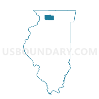
MARYLAND Voting District, Ogle County, Illinois
About
Outline

Summary
| Unique Area Identifier | 573753 |
| Name | MARYLAND Voting District |
| County | Ogle County |
| State | Illinois |
| Area (square miles) | 36.04 |
| Land Area (square miles) | 36.02 |
| Water Area (square miles) | 0.02 |
| % of Land Area | 99.95 |
| % of Water Area | 0.05 |
| Latitude of the Internal Point | 42.16456990 |
| Longtitude of the Internal Point | -89.50223950 |
Maps


Graphs
Select a template below for downloading or customizing gragh for MARYLAND Voting District, Ogle County, Illinois


Neighbors
Neighoring Voting District (by Name) Neighboring Voting District on the Map
- FORRESTON 1 Voting District, Ogle County, IL
- FORRESTON 2 Voting District, Ogle County, IL
- FORRESTON 3 Voting District, Ogle County, IL
- LEAF RIVER Voting District, Ogle County, IL
- LINCOLN Voting District, Ogle County, IL
- MT MORRIS 2 Voting District, Ogle County, IL
- RIDOTT 2 Voting District, Stephenson County, IL
- SILVER CREEK Voting District, Stephenson County, IL
Top 10 Neighboring County Subdivision (by Population) Neighboring County Subdivision on the Map
- Mount Morris township, Ogle County, IL (3,968)
- Forreston township, Ogle County, IL (2,080)
- Ridott township, Stephenson County, IL (1,451)
- Leaf River township, Ogle County, IL (1,137)
- Silver Creek township, Stephenson County, IL (696)
- Maryland township, Ogle County, IL (535)
- Lincoln township, Ogle County, IL (481)